Town Tales
Workshop: 14. u. 15. Sept. 2017; Präsentation: 15.09.2017, 10.10 Uhr Herder-Institut , Marburg
Geographic Information Systems (GIS) as an opportunity and a challenge for digital history: Exploring approaches to maps, aerial photographs and spatial statistics
Marion Starzacher, Universitätsprofessorin für technisches Werken, stellt im Rahmen des Workshop ihr Forschungsprojekt 'Town Tales – Visualization of the Development of the City of Graz, based upon Historical Maps‘ vor.
Der Franziszeische Kataster, auch als „Stabiler Grundsteuerkataster“ bekannt, stellt die erste maßstäbliche Vermessung der gesamten Habsburgermonarchie zwischen 1817 und 1861 dar. Die Landvermessung von Graz und den umliegenden Gemeinden von 1820 und die bisher nicht bekannte Zweitvermessung desselben Gebietes standen im Sommersemester 2012 im Fokus der Lehrveranstaltungen Bauforschung und Analyse Historischer Architektur des Institutes für Stadt- und Baugeschichte unter der LV-Leitung von Marion Starzacher und Elisabeth Seuschek. Diese Lehrveranstaltungen sind Teile des Forschungsprojektes 'Town Tales – Darstellung der städtebaulichen Entwicklung der Stadt Graz auf Basis von historischem Planmaterial‘.
The workshop is part of the project on "Conceptualizing digital access to aerial photography", generously funded by the German Federal Ministry of Education and Research (BMBF).
Geographic Information Systems (GIS) as an opportunity and a challenge for digital history: Exploring approaches to maps, aerial photographs and spatial statistics.
The „Franziszeischer Catastre“, also named as „Stable Land-Tax-Catastre“, is the first scaled measurement of the monarchy of Habsburg in the years 1817 to 1861. The land survey of Graz and surrounding municipalities in the year 1820 and the former unknown second land survey of the same region in the year 1829 were the objectives from two courses in summerterm 2011, held by Marion Starzacher and Elisabeth Seuschek at the TU Graz. These two courses are parts of the project 'Town Tales – Visualization of the Development of the City of Graz, based upon Historical Maps‘.

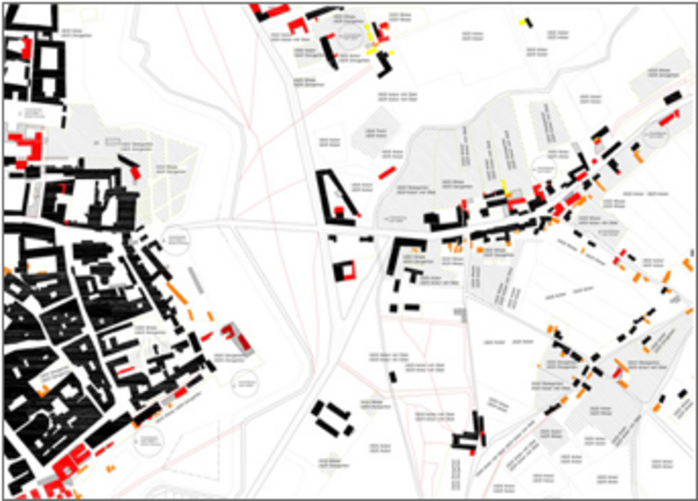
Grafik N. Kern, U. Tinnacher. 2012.